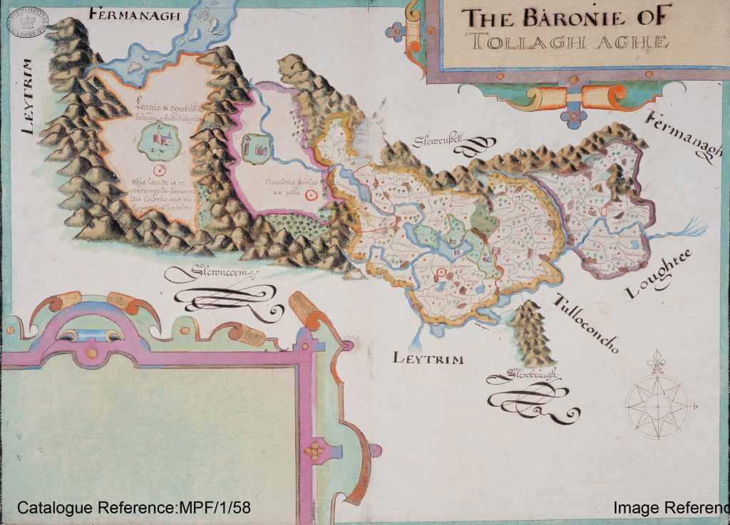
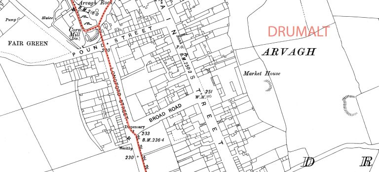
Maps of Cavan towns c.1910, showing townland boundaries.
Your gateway to the history of each of Cavan's 2,000 townlands
All posts relating to historical and contemporary maps of Co. Cavan.

Maps of Cavan towns c.1910, showing townland boundaries.
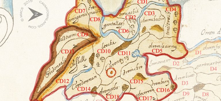
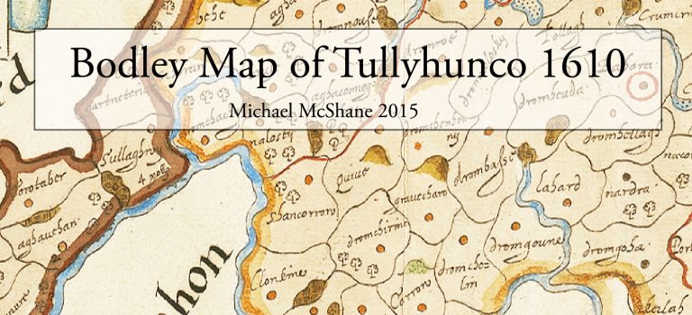
This is a detailed comparison of the barony map of Tullyhunco with the present day mapping of the area. Below you can see the individual plantation estates, or proportions as they were called. In preparation for the Plantation of Ulster forces of the Crown were tasked with surveying the escheated (confiscated) counties of Ulster vacated after the Flight of the Earls in 1607. This work was overseen by Sir Josias Bodley who presented the completed maps to King James I in 1610.
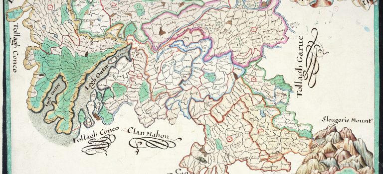
In preparation for the Plantation of Ulster forces of the Crown were tasked with surveying the escheated (confiscated) counties of Ulster vacated after the Flight of the Earls in 1607. This work was overseen by Sir Josias Bodley who presented the completed maps to King James I in 1610.
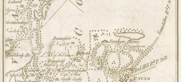
We have extracted all the Cavan related maps from this comprehensive set of road maps which were prepared for the entire country by Taylor & Skinner in 1778. When viewed as a set they cover a substantial part of the County and are the only maps to this level of detail prior to the Ordnance Survey maps which followed in the 1830’s. Click on the images below to enlarge.
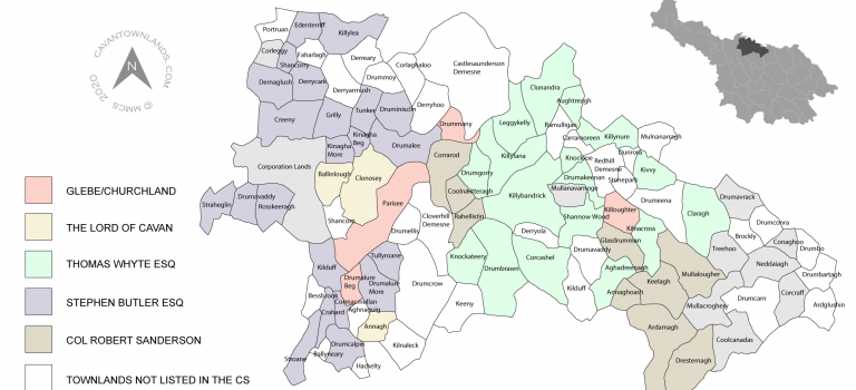
These parish maps, covering the entire of County Cavan, have been prepared by Michael McShane from the information contained in the Commonwealth Survey of 1652/53. They visually chart the evolution of the plantation estates and contain information on the proprietors of the lands at this time. Click on the images below to enlarge.
After the flight of the earls in 1607 the six escheated (confiscated) counties of Ulster which comprised Armagh, Cavan, Donegal, Fermanagh, Derry and Tyrone came under direct rule of the crown. The process of plantation began in 1608 when plans were drawn up for the granting of these counties to the various entities who were in the favour of King James I. Dealing with the Natives, the selection of suitable candidates to undertake the Plantation and a fear of invasion by the Earl of Tyrone delayed the process for nearly a year.
Click on the image below to read the full 2015 article:
The previous survey of 1608[1] comprised of a written description of the lands only and was not deemed adequate for the purposes of Plantation. In order to grant estates it would be necessary to ensure that the polls/townlands making up the various Proportions were allocated in a logical manner. Mapping was deemed to be the only way to guarantee that this was the case and would confirm that the townlands in each proportion were contiguous and created sensible boundaries for the estates which could then be managed with relative ease. The strategic relationship of the boundaries to natural features including rivers, mountains, woodland and bogs was also essential to the smooth management of the newly created estates.
Prior to this time very little in the form of detailed survey maps for the escheated counties existed and what was available lacked any great accuracy or information which would be useful in the process of plantation.
[1] Analecta Hibernica III (1931) pp 151-218
The survey of the six counties commenced on the 31st July 1609. A military expeditionary force, led by Sir Arthur Chichester, was assembled to carry out the work which included the holding of inquisitions, settling of disagreements regarding estates to be forfeited or otherwise, holding assizes and the actual charting of the lands.
The commissioners agreed to select out of every barony men that were able to nominate, meere, and bound every parish, balliboe, or ballybetagh ; and these were to attend Sir Josias Bodley and the surveyor, William Parsons, who were to make card [chart or map] of every country.” [1]
A very comprehensive description of the entire undertaking is given in ‘The Maps of the Escheated Counties of Ulster, 1609-10’ by J.H. Andrews[2]. I briefly summarise here some of the salient points which are relevant to this article and I highly recommended this paper for further reading on the subject for those interested in the minutiae.
Records show that eight men were appointed specifically as surveyors as part of this expeditionary force. They were:
| William Parsons | Irish surveyor-general was paid £100 |
| George Sexten | Escheator and clerk of the crown in Ulster was paid £30 |
| Sir Josias Bodley | Superintendent of the Castles in Ireland was paid £133 6s. 8d. |
| Sidrack Davenport | Transcriptor of the exchequer was paid £26 13s. 4d. |
| John Merrick | Junior assistant who was paid £20 |
| William Rolls | Deputy to Parsons was paid £30 |
| Thomas Raven | Assistant to Parsons who later became one of the most respected cartographers of his time and was paid £30 for his services |
| John Rawson | Draughtsman assigned to colouring the maps was paid £10 |
Parsons, Bodley, Davenport, Merrick, Rolls and Raven were employed for the ‘surveying and plotting’ of the six counties and afterwards ‘framing and drawing up the plots and descriptions’[3]. Sexten was chiefly involved in the administration of the effort and Rawson was to colour the maps. At the time both Bodley and Parsons were credited equally with the overseeing of the mapping process but Bodley later claimed that the survey and the maps produced was ‘his invention wholly’[4] This may well be true as Parsons was not well respected by, amongst others, Thomas Raven as having any great skill in this regard and he is not accredited with having ever made a map on his own without technical assistance. Also his professional conduct has been called into question:
‘His then fellow worker, Parsons, had the reputation of doing strange things in his surveys for himself and his friends ; and assuredly some such jobs must have been perpetrated in that survey.’[5]
Progress was good and Armagh had been finished by the 10th of August, Tyrone by the 24th and Coleraine within a day or two of the end of the month. Donegal was complete, or nearly so, by the 12th of September and Fermanagh by the 20th. The commissioners struck camp in Cavan on the last day of the month, and the surveyors were paid up to the 3rd of October. They had mapped nearly 5,700 square miles in sixty-seven days.[6]
[1] Rev. George Hill, An historical account of the Plantation in Ulster at the commencement of the seventeenth century 1608-1620. (Belfast 1877) p.153
[2] J. H. Andrews, The Maps of the Escheated Counties of Ulster, 1609-10. Proceeding of the Royal Irish Academy. Vol 74 (1974)
[3] J. H. Andrews, The Maps of the Escheated Counties of Ulster, 1609-10. Proceeding of the Royal Irish Academy. Vol 74 (1974) p.142
[4] Rolf Loeber, A Biographical Dictionary of Architects in Ireland 1600-1720. (1981) p.23
[5] Rev. George Hill, An historical account of the Plantation in Ulster at the commencement of the seventeenth century 1608-1620. (Belfast 1877) p.194
[6] J. H. Andrews, The Maps of the Escheated Counties of Ulster, 1609-10. Proceeding of the Royal Irish Academy. Vol 74 (1974) p. 142
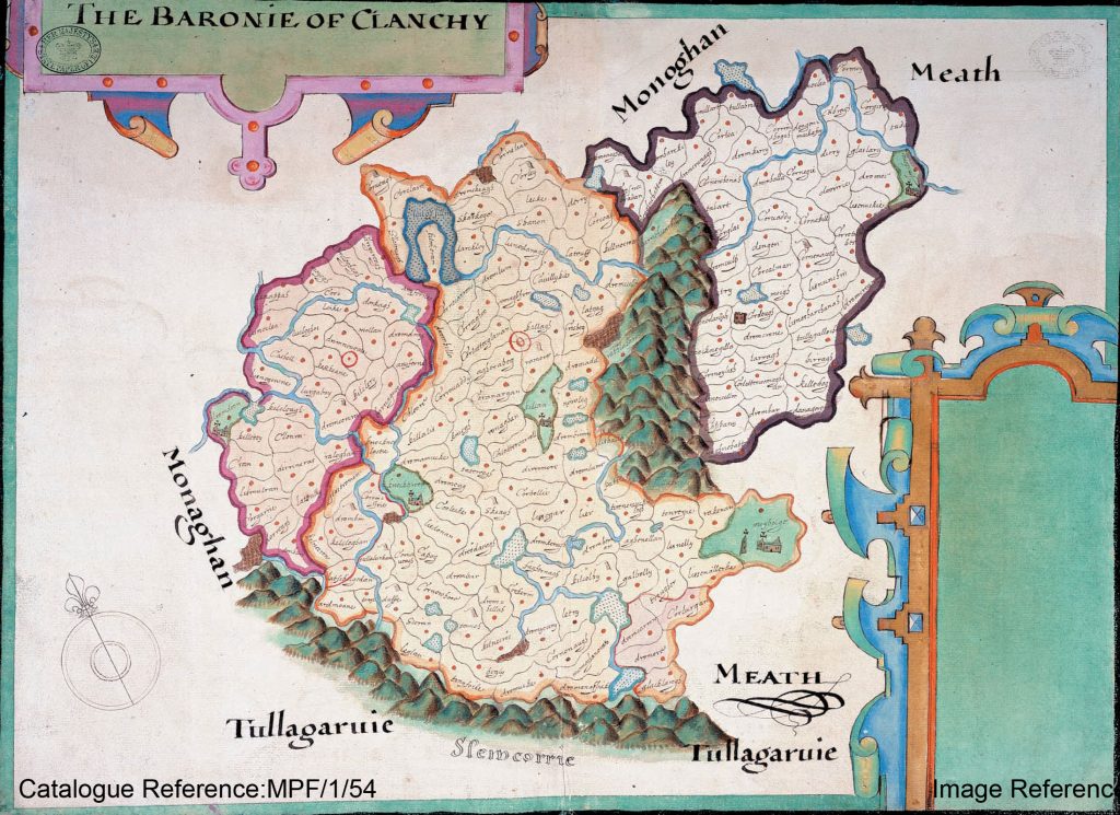
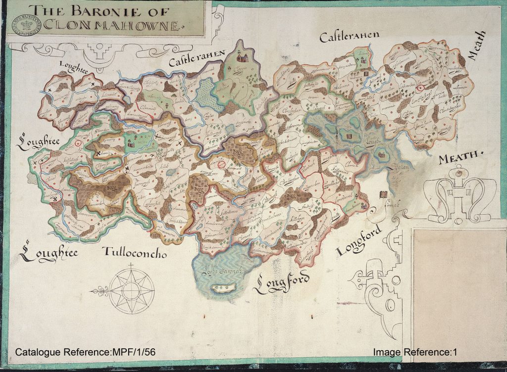
Cavan was the last county of the six to be surveyed. The commissioners, of which there were eleven, began to assemble in Cavan town on the weekend of the 22nd of September. The Inquisition[1] was held on Monday the 25th. Local knowledge was provided to the commissioners by the following jurors:[2]
| 1. | Garrett Fleminge, Esquire. |
| 2. | Thomas Kernan. |
| 3. | Hugh McDonell Brady. |
| 4. | Thomas Brady. |
| 5. | Patrick Brady. |
| 6. | Owen boy O’Ferally. |
| 7. | Mulmore McCale [Cahill] Reilie. |
| 8. | Shane O’Gowne |
| 9. | Donell McFerall Oge McKernan. |
| 10. | Tirlagh Oge McKernan. |
| 11. | Felim McGauran. |
| 12. | Cormock McKernan. |
| 13. | Shane McCalmoyle Brady. |
| 14. | Mahowne McOwen Brady. |
The commissioners were fortunate that much of the work on Cavan had already been completed and valuable time was saved:
As to the temporal lands, they had already vested in the Crown by the deaths in quick succession of three chiefs of the O’Reilly’s, viz., Sir John O’Reilly, his brother Philip, and their uncle Edmond, who were all slain fighting on the side of Hugh O’Neill Earl of Tyrone, and whose estates, therefore, fell to the Crown by a law in this country which, under such circumstances, dispensed with the necessity of any legal proceedings. All that had to be done was, simply to ascertain by inquisition whether they had fallen when in actual rebellion, and this fact was sufficiently established by an investigation at Cavan, on the 19th of August, 1606. The commissioners and jurors in 1609 were, therefore, saved any trouble as to the general question of temporal lands ;[3]
While this work was ongoing in Cavan town, Bodley, Parsons and the other surveyors were travelling throughout the county gathering the necessary information for their map making purposes.
At the close of the commissioners’ labours in Cavan, the last county of the six, Davys penned his concluding epistle to Salisbury, evidently in high spirits that his opinion on the subject of the termon lands had been amply borne out by special examination, and that he was about to leave Ulster in profound peace ! “ We are now come to the Cavan,” says he, “ which is the last period of our long progress, and have there performed our several services in the same manner as in the former counties.[4]
On the 3rd of October 1609 they headed back to Dublin in confident mood.
They have left the province of Ulster in more complete peace and obedience than has ever been seen since the Conquest. [5]
Two months, at least, was requested to complete the work on their return to Dublin:
And now although they have ended this journey, for this day their camp is broken up, they have not yet ended their business; for the making up of these inquisitions in form of law, the drawing of the titles into the cases, the engrossing, enrolling, and exemplification thereof, the absolute finishing of the maps, the limiting and setting forth of the parishes, precincts, and proportions, which must be done upon the maps, with divers other real parts of the main service, are to be performed after they return home, which will require extraordinary labour and diligence, and two months’ time at least.[6]
The work was not completed until late February in 1610. It was mid March before their results were finally presented to the King and his ministers. Six bound books of maps, one for each county, were presented along with the written description of their findings.
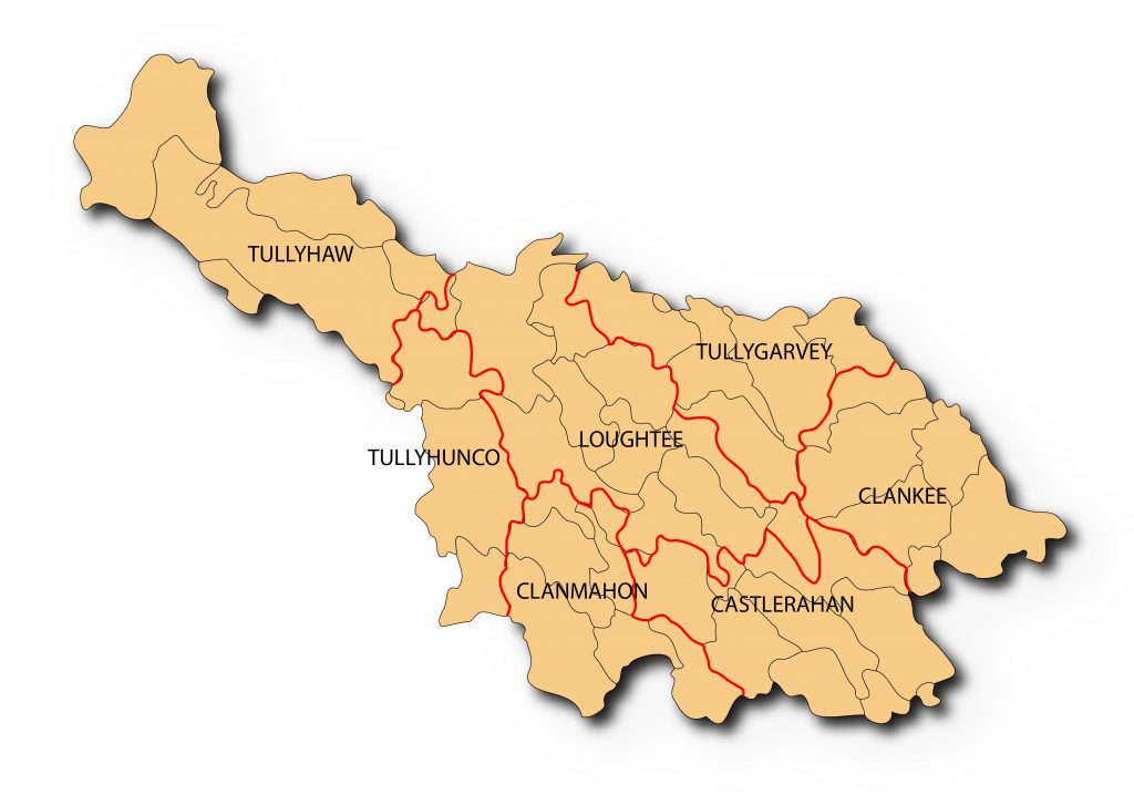
Among the papers carried by the two Plantation Commissioners, Davys and Ridgeway, to London was the following tabulated form of the numbers, names and quantities of the great precincts (or baronies) in the escheated counties “which may be clearly disposed to undertakers”[7]
| 1. Loughtee | 12,500 acres |
| 2. Tulloghgarvy | 7,500 acres |
| 3. Clanchy | 6,000 acres |
| 4. Castlerahin | 9,000 acres |
| 5. Clonmahon | 7,000 acres |
| 6. Tullochonco | 6,000 acres |
| 7. Tullagha | 9,000 acres |
Tullyhunco was then subdivided into 6 Small proportions deemed suitable for planting (the proportion of Drong was left in native hands) and in April 1609 the lands were allocated by lot to the Scottish undertakers thus:
| Clonkine | 1,000 acres | Sir Alexander Hamilton |
| Carrotubber | 1,000 acres | Sir Alexander Hamilton |
| Clonyn | 1,000 acres | Sir Claude Hamilton (son of the above) |
| Dromheada | 1,000 acres | Alexander Achmootie |
| Keylagh | 1,000 acres | John Achmootie |
| Corradonan | 1,000 acres | John Browne |
[1] Philip O’Connell, The Cavan Inquisition of 1609 (The Breifny Antiquarian Society’s Journal, Vol III, pp. 361-386 1934)
[2] Rev. George Hill, An historical account of the Plantation in Ulster at the commencement of the seventeenth century 1608-1620. (Belfast 1877) p.185
[3] Ibid., p.187
[4] Ibid., p.188
[5] Ibid., p.189
[6] Ibid., p.189
[7] Ibid., p.201
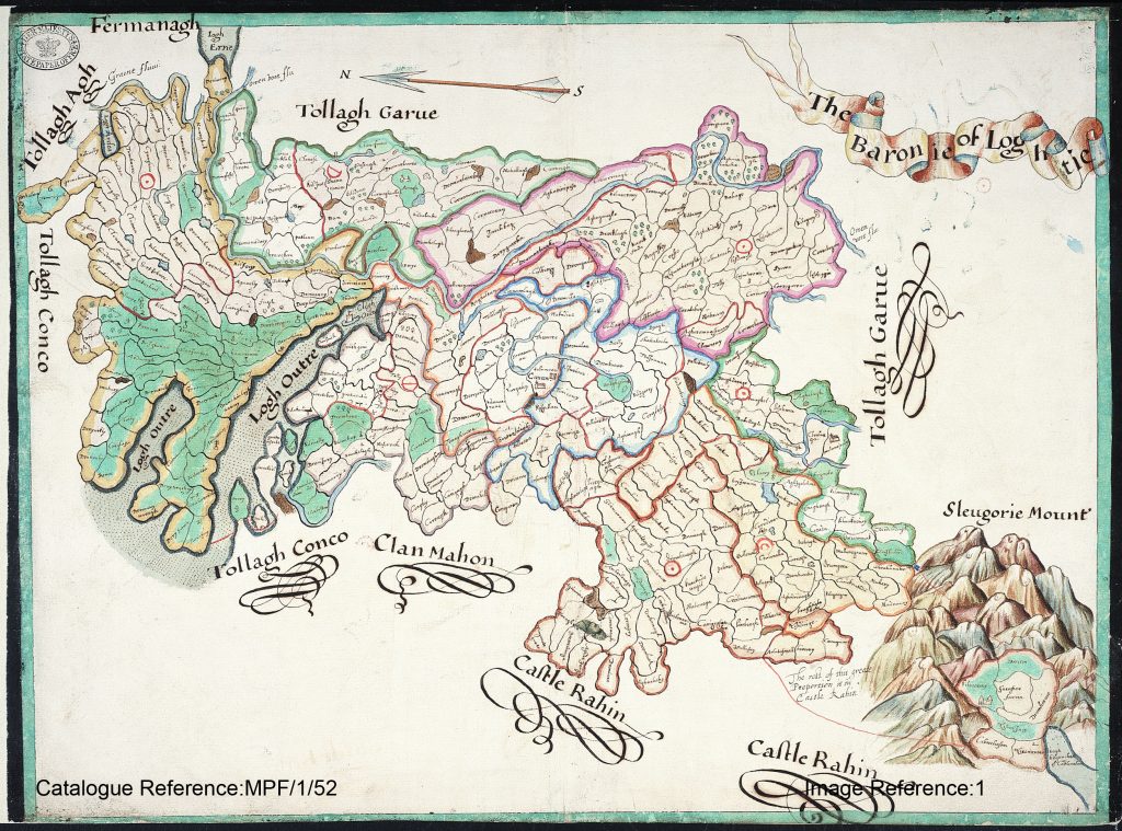
Perhaps overlooked in earlier studies of the Bodley maps is the significance of the large blocks of territories outlined in various tinted colours. From a close examination of the Tullyhunco map it is clear that the 3 areas (from the left) outlined in brown, orange and green represent the parishes of Scrabby, Killeshandra and Kildallan. This is the first time that the ancient Irish parishes have been presented in cartographic format and in such detail thus providing a comprehensive record of the townlands in each parish at that time. Scrabby is shown to comprise 10 townlands, Killeshandra 81 townlands and Kildallan 46 townlands.
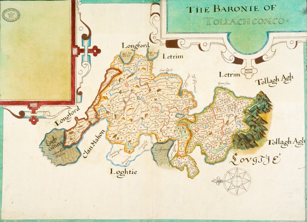
Much has been written in numerous articles and publications about the questionable methods used to prepare the maps and the many inaccuracies which are evident throughout the final set of charts as presented to King James I, in March 1610.These criticisms may be fair on one level but I personally cannot overestimate the significance of this monumental achievement which was completed in a very short period of time and with very limited resources. The sheer scale of the task, even in terms of available technologies today, was enormous. The ability to deliver the level of information within the timescale allotted was formidable. What transpired was the implementation of a very creative process of information gathering which was cross-referenced to physical features on the ground resulting in these magnificent groundbreaking maps. It was Bodley’s ability to use his unique skills and in a fashion which had never been attempted before which brought about this stunning set of records and the preservation of ancient townland names which would surely have been lost otherwise. The 1609 maps provide the historian with a unique time-capsule which can be used to trace back and link some of the earliest townland names to their present day counterparts. No set of maps at this scale of detail pre-exists for the counties covered. It is the baseline for the cartographic study of the townlands which were fortunate enough to have been included in the process. Bodley went on to map many other parts of Ireland. His legacy is still with us today and is testament to his skill and ingenuity.
