The One Inch series of Ordnance maps first appeared in 1858 based on reductions of the six-inch county maps of the time. The sheets were split and regrouped into the now familiar 205 sheets which cover the entire country. By the 1890s the first edition maps were seen as out-dated in both style and content and were replaced by the second edition which were coloured, mounted between two boards and made more suitable for outdoor use. These maps are very useful for the local historian as quite an amount of detailed information can be gleaned from these documents including individual houses, recently constructed railway lines.
Index to the one-inch series of Ireland:
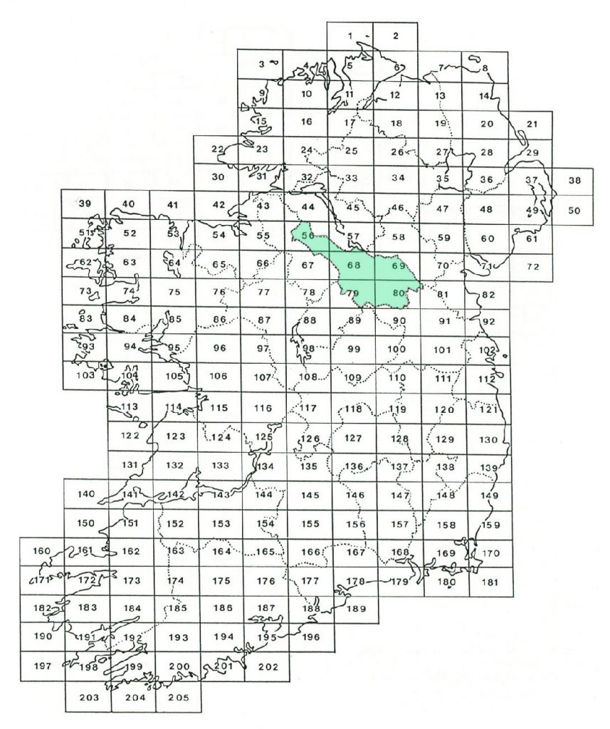
One-inch maps which cover County Cavan:
| Map No. | Location | Surveyed | Revised | Published | Printed |
| 56 | Swanlinbar | 1899 | 1905 | ||
| 57 | Lisnaskea | 1833-36 | 1900 | 1902 | 1903 |
| 67 | Carrick on Shannon | 1836-38 | 1899 | 1901 | 1904 |
| 68 | Cavan | 1836 | 1900 | 1902 | 1903 |
| 69 | Cootehill | 1834-36 | 1900 | 1902 | 1903 |
| 79 | Granard | 1899-00 | 1903 | ||
| 80 | Ballyjamesduff | 1837-39 | 1899 | 1902 | 1903 |
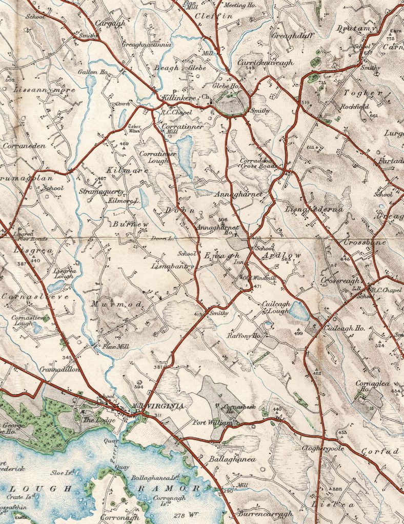
Sample One-inch map, extract from Sheet 80, 1902: