Courtesy of Cavan County Library we reproduce below their index to the townlands for which the 1821 census returns survive.
1821 Census Records

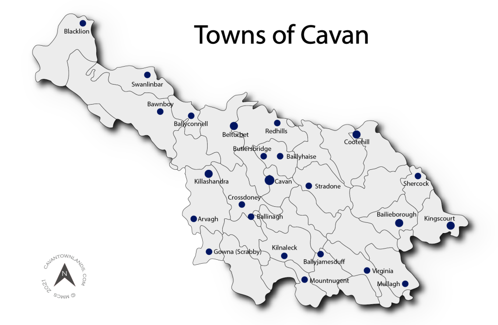
Towns of Cavan – Earliest census records
Introduction
Of the earliest records of County Cavan for which detailed individual returns are available it can at times be problematic searching for and retrieving that elusive name. Elsewhere on this website we have provided guides to searching these records with particular emphasis on the townland of origin. To date we have gone into considerable detail on the 1821 census of Cavan (80,000 records) and the census substitute of c.1832, the Tithe Applotment Books (TAB 30,000 records) and the limited but no less valuable 1841 census of the parish of Killashandra (15,000 records). These datasets are very valuable as they represent the only detailed records, apart from religious and estate records, from these periods. Having trawled the information as presented on the National Archives (NAI) website it became apparent that there were considerable issues with the data including poor transcriptions and questionable indexation resulting in false results which could easily lead to abandoned and futile searches.
Overview
In this article we set out to identify what, if any, records are available in relation to the towns of Cavan and to present our findings in as clear and precise a manner as possible. It has to be pointed out that each town is unique in terms of the information available and how that information is best accessed. Some towns were clearly identified by the enumerators at the time of recording the information, a close examination of the original census forms has established what information is available. In some instances, where the town straddles a number of townlands (or even parishes), the records have been split resulting in situations where the town is presented in a fragmented manner, or even not at all. Some townlands combine urban as well as rural areas and where no breakdown is provided it requires checking each individual entry in terms of occupation and other factors. Some towns lie entirely within bounding townlands. There are a number of instances where the name of the townland and the town vary eg. the town of Shercock lies within the townland of Lisdrumskea but no mention of Shercock turns up in the index. In other cases the town and townland name match eg. the town of Mullagh lies in the townland of Mullagh. Larger towns are more complex eg. Cavan town which straddles at least 7 townlands, some of which were incorporated into the town records but others were not.
What we did
We extracted all the available Cavan related census data from the NAI website. This included a considerable number of records which were incorrectly indexed in a number of other counties throughout the country. This allowed us to create a master set of all the entries for both the 1821 and TAB collections. We then reassigned the extracted records to their unique Logainm identification (logainm.ie) by matching old, misspelt and poorly transcribed versions of townland names to their correct denomination. This gave us a greatly improved and re-indexed dataset to work with. By referring to maps which we have prepared indicating townland boundaries overlayed on the town plans we identified the townlands whose records cover the urban district. We then set about extracting the individual town records. It is our belief that the errors encountered on the NAI site have concealed a very significant portion of the transcribed town records. The corrected results which we present here hopefully go some way towards redressing the situation in a meaningful way.
Reconciling the data turned out to be a very time consuming exercise and it must be pointed out that it can be an imprecise art given the varying quality of the source material. In many cases we used our best judgement to assign records to the towns. At the end of the day the only reliable result will be found by drilling down to the photograph of the original record. We did not make any changes to the individual records as they were transcribed.
A homepage for each town
We have created a homepage for each of the towns listed in the table below (click on the town name to go to that homepage). Each home page will show the following information where available: Description of the town from Lewis’s Topographical Dictionary 1837, Map of the town c.1910 showing townland boundaries, Census population summary 1821-1911, Individual records for 1821, individual records for c.1832 TAB, Individual records for 1841 (Killashandra only) and individual records for 1857 Griffith’s. We are currently working on the 1901 and 1911 census returns for the county and these will be uploaded in due course.
Before searching the results which we present on the town homepages we strongly suggest that the guidance notes below be consulted as it may be necessary to search beyond the town homepage in order to get the complete picture. For clarity we have left some town records as found in their townland pages and these need to be looked at separately.
Available records
| Town | Parish | 1821 | TABs | 1841 | Griffiths |
|---|---|---|---|---|---|
| Arvagh | Killashandra | ✔ | ✔ | ✔ | |
| Bailieborough | Bailieborough | ✔ | |||
| Ballinagh (Bellananagh) | Kilmore | ✔ | ✔ | ✔ | |
| Ballyconnell | Tomregan | ✔ | ✔ | ||
| Ballyhaise | Castleterra | ✔ | ✔ | ||
| Ballyjamesduff | Castlerahan/Denn | ✔ | ✔ | ||
| Belturbet | Annagh/Drumlane | ✔ | ✔ | ||
| Blacklion | Killinagh | ||||
| Butler’s Bridge | Castleterra | ✔ | |||
| Cavan | Urney | ✔ | ✔ | ||
| Cootehill | Drumgoon | ✔ | ✔ | ||
| Crossdoney | Kilmore | ✔ | ✔ | ||
| Killashandra | Killashandra | ✔ | ✔ | ✔ | |
| Kilnaleck | Crosserlough | ✔ | ✔ | ||
| Kingscourt | Enniskeen | ✔ | ✔ | ||
| Lough Gowna | Scrabby | ✔ | ✔ | ||
| Mount Nugent | Kilbride | ✔ | ✔ | ||
| Mullagh | Mullagh | ✔ | ✔ | ||
| Shercock | Shercock | ||||
| Stradone | Larah | ✔ | ✔ | ||
| Swanlinbar | Kinawley | ✔ | |||
| Virginia | Lurgan | ✔ | ✔ | ✔ |
Guidance notes on using this search facility.
CT=CavanTownlands NAI=National Archives of Ireland TAB=Tithe Applotment Books
Arvagh, Parish of Killashandra.
The town stands on the townlands of Drumalt, Drumnawall, Ticosker and Ticosker Glebe.
1821 Census: Population 289. No individual records available.
TAB 1832: The town is identified in the original records. There are 33 individual leaseholder entries for Arvagh town and these are presented on the CT Arvagh town homepage. The records of the adjoining townland of Drumnawall should also be consulted as part of Longford Street lies here.
1841 Census of Killashandra: Population 615. Entries for Arvagh Town were found under the townland of Drumalt where 111 households are recorded. 789 individuals are identified here but include some rural listings. The adjoining townlands of Drumnawall (166 individuals) and Ticosker are also worth checking out.
Bailieborough, Parish of Bailieborough.
The town stands on the townlands of Drumbannan and Tanderagee.
1821 Census: Population 804. No individual records available.
TAB 1832: The town is identified in the original records. Records on the NAI website were incorrectly indexed under County Meath. These 40 records are now listed on the CT Bailieborough town homepage. The town falls within the townland of ‘Tandargee’ so these records should be consulted also (18 records).
Bellananagh/Ballinagh, Parish of Kilmore.
Bellananagh/Ballinagh town stands on the townland of the same name.
1821 Census: Population 900. The town of Ballinagh shows 871 records. Individual records are available here.
TAB 1832: The town is identified in the original records. The records for Ballinagh town were incorrectly indexed under County Mayo and were found under the townlands of ‘Ballynagh’ (21 records) and ‘Ballinagh and Town Parks’ (37 records). These records can be viewed under the CT Bellananagh town homepage.
Ballyconnell, Parish of Tomregan.
The town stands on the townlands of Annagh, Cullyleenan, Derryginny and Doon.
1821 Census: Population 353. No individual records available.
TAB 1832: The 47 records for the town of Ballyconnell turn up in the townland of Doon (spelt Doone on the NAI site and was indexed under County Fermanagh). We have re-indexed these records to the town of the CT Ballyconnell homepage. The records of the adjoining townlands of Cullyleenan (transcribed Coolelan) has 18 entries and Derryginny (transcribed as Deniginney and Denintunny) has a total of 12 entries which should be consulted.
Ballyhaise, Parish of Castleterra.
The town stands on the townland of Townparks.
1821 Census: Population 726. Ballyhaise Town turns up 759 entries. Individual records are available here.
TAB 1832: The 56 records for the town were recorded under the townland of Cornacunny (transcribed Curnacunny). These records are now reindexed under Ballyhaise town and can be viewed on the CT Ballyhaise town homepage.
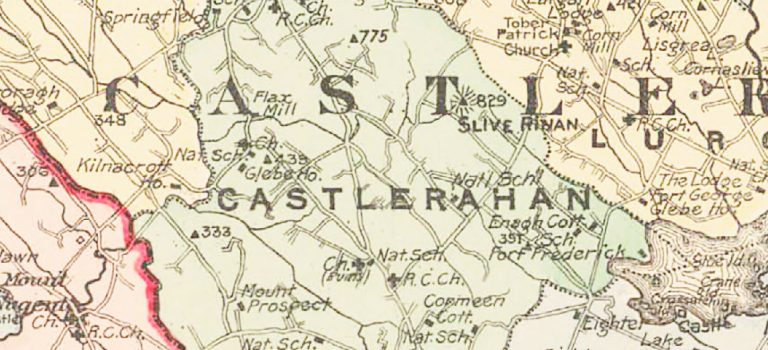
Ballyjamesduff, Parish of Castlerahan.
The town stands on the townlands of Cornahilt and Moodoge.
1821 Census: Population 423. We list 426 records on the CT Ballyjamesduff town homepage.
TAB 1832: The town was not specified in the original records but entries can be found in the townlands of Cornahilt (21 records) and Moodoge (8 records).
Belturbet, straddles the parishes of Annagh and Drumlane.
1821 Census: Population 2010. No individual records available.
TAB 1832: The bulk of the town town falls within the townland of ‘Corporation Lands’ and we have used these 36 records for our CT Belturbet town homepage listing. The town also straddles the townlands of Kilconny (107 entries) and Straheglin (13 entries) and these should be consulted.
Blacklion, Parish of Killinagh.
The town stands on the townland of Tuam.
1821 Census: Not identified as a town in the returns. No individual records available.
TAB 1832: The town lies within the townland of Tuam (transcribed Tuom on the NAI website) and turns up 10 entries. We have moved these records to the town listing.
Butlersbridge, Parish of Castleterra.
The town stands on the townlands of Derrygarra Lower, Derrygarra Upper, Drummany and Tullybrick.
1821 Census: The NAI site has the town incorrectly transcrbed as ‘Buttersbridge’.The town does not appear in the official census return summary of County Cavan for that year. We have re-indexed the 158 entries to the CT town homepage for Butlersbridge. The town straddles a number of townlands and we suggest that the 120 records of Kilnaglare Upper and the 70 Derrygarra Lower be consulted as some of the occupations of the individuals listed here suggest they are town dwellers, but predominantly farming related jobs here too so judgements will have to be made. The adjoining townland of Drummany should also be consulted.
TAB 1832: The town lies on the adjoining townlands of Drummany (transcribed Drumany) with 10 entries, Kilnaglare with 5 entries and Derrygara Lower (transcribed Deragara) with 5 entries. These townland entries should be consulted as the town was not specifically identified in the original records.
Cavan, Parish of Urney.
The town straddles at least 6 townlands which are as follows: Townparks, Abbeyland, Lurganboy, Drumvanagh, Keadew and Kinnypottle.
1821 Census: Population 2322. No individual records have survived that we are aware of.
TAB 1828: We have re-indexed 326 entries to the CT Cavan town homepage which were originally recorded under the following names: ‘Cain’, ‘Cavan’, ‘Cavan Town’ and ‘County House’ in the NAI listings. Records listed under the following townlands should also be consulted: Lurganboy (16 entries under various spellings of this townland name), Drumavanagh (24 entries), Kinnypottle (31 entries under ‘Kenny Pottle’ and ‘Kennypottle’) and Kilnavarra (57 entries). Note that on the NAI website a significant number of returns for Cavan town were indexed under the Parish of Annagelliff and these records cover 4 years of taxation so there are multiple entries with much duplication.
Cootehill, Parish of Drumgoon.
The town stands on the townlands of Bellamont Forest, Magheranure, Munnnilly, Drumaveil North, Glebe and Killycramph.
1821 Census: Population 2152. No individual records available.
TAB 1828: The town is identified in the original records (37 entries) but the NAI data for this parish were incorrectly indexed under the parish of Drumgooland in County Down. (The records which are indexed Drumgoon parish in Cavan are actually the Drumlane parish records.) The records cover a period of at least 3 years and are duplicated. Cootehill lies predominantly within the townlands of Magheranure and Munnilly. Magheranure was transcribed as Maheramayo, Magheranure, Maheranura, Maheranure and Mahoranure (total 147 entries). Munnilly was transcribed as Munally (29 entries). These townland records should be consulted as we have not reassigned the records to the town homepage.
Crossdoney, Parish of Kilmore.
1821 Census: Not identified as a town but 134 individual records are recorded in the townland of the same name. These records have now been reassigned to the CT Crossdoney town homepage.
TAB 1832: The records were found misfiled under ‘Crossdony and Town Karks (Parks)’ in the parish of Kilmore, Co. Mayo. 15 records have now been reassigned to the CT Crossdoney town homepage.
Killashandra Town, Parish of Killashandra.
Killashandra Town stands on the townlands of Portaliff Glebe and Portaliff, or Townparks.
1821 Census: Population 1148. No individual records available.
TAB 1832: The town is identified in the original records. 99 records listed under ‘Kilesandra’, ‘Kilchandra’, ‘Killeshandra’ and ‘Killashandra Town’ have now been re-indexed to the CT Killashandra town homepage.
1841 Killashandra Parish Census: Population 1085. 1,360 entries are listed here over 207 houses. These entries were not clearly identified as Killashandra town but a close examination confirms that they are the records of the town but possibly include some rural areas also.
Kilnaleck, Parish of Crosserlough.
Kilnaleck Town stands on the townlands of Coolkill, Kilnaleck and Tonylion.
1821 Census: Population 332. 343 individual entries which were listed for the townland of Kilnaleck have now been reassigned to the CT Kilnaleck town homepage. It is also worth checking the 292 entries of the adjoining townland of Coolkill. Tonylion adjoins also and should be consulted.
Tab 1828: 63 leaseholder records appear under ‘Kilnaleck’ and have now been reassigned to the CT Kilnaleck town homepage. Also look at the adjoining townland of Tonylion which is listed as ‘Tonylion Kinaleck’ on the NAI website, 15 entries here. No entries were found for Coolkill.
Kingscourt, Parish of Enniskeen.
The town stands on the townlands of Dunaree, Lisanisky and Lisasturrin.
1821 Census: Population 1458. No individual records available.
TAB 1832: This parish was indexed under County Meath. 115 records appear for this town which is clearly identified as ‘Town of Kingscourt’ in the written records. These records can now be viewed on the CT Kingscourt town homepage. It lies within the townlands of Dunaree (transcribed as Dunaree and Donarll, 57 entries), Lisanisky and Lisasturrin.
Lough Gowna (Scrabby), Parish of Scrabby.
The town stands on the townland of the same name.
1821 Census: Population 321. No individual records available.
TAB 1832: 39 entries appear in the NAI site for ‘Scraby’. These have now been reassigned to the CT Lough Gowna/Scrabby town homepage.
Mountnugent, Parish of Kilbride aka Castlecor.
1821 Census: Population 99. 97 entries appear for the townland of Mountnugent which we have reassigned to the CT Mountnugent homepage. Individual records are available here.
TAB 1832: The records for this parish were indexed under Co. Meath. 6 records appear under ‘Mt Nugent’ and these can now be viewed on the CT Mountnugent homepage.
Mullagh, Parish of Mullagh.
Mullagh town stands on the townland of the same name.
1821 Census: Not identified as a town in the 1821 return. 322 individual entries appear in the townland which includes the village.
TAB 1833: The parish of Mullagh was combined with and recorded under the parish of Killinkere. The town of Mullagh lies within the townland of Mullagh. 8 entries appear under Mullagh in the NAI site and a further 26 entries are recorded under ‘Mullough’ which include the village. The combined 34 records can now be viewed on the CT Mullagh townland page.
Redhills, Parish of Annagh.
Redhill town stands on the townlands of Carramoreen, Drumakeenan, and Knockroe.
1821 Census: Not identified as a town. No individual records available.
Tab 1832: Redhills village straddles the townlands of Redhill Demesne (11 entries) and Drumakeenan (12 entries) and Knockroe (‘Redhills or Knockrow’ 28 entries). These townlands should be consulted as the town was not specifically identified in the original documents.
Shercock, Parish of Shercock.
The town stands on the townland of Lisdrumskea.
1821 Census: Population 383. No individual records available.
TAB 1832: The town of Shercock lies within the townland of Lisdrumskea. The townland was originally recorded as ‘Drumskea’ and 20 entries were found here. These have now been reassigned to Lisdrumskea townland. (Note a search for ‘Shercock’ on the NAI website turns up 8 records which should be ignored)
Stradone, Parish of Larah.
1821 Census: Population 272. We list 282 individual returns on the CT Stradone town homepage.
TAB 1832: The town lies within the townland of Drumlaunaght which should be consulted ( Transcribed as ‘Drumlannett’ and ‘Drumlaunalt’ and other variations with 39 entries). Adjoining townlands should be consulted here including Raheelagh and Corraneary.
Swanlinbar, Parish of Kinawley.
Swanlinbar town stands on the townlands of Furnaceland and Hawkswood.
1821 Census: Population 357. We list 362 individual returns on the CT Swanlinbar town homepage. See also Hawkswood (25 entries) and Furnaceland (168 entries).
TAB 1832: The town lies within the townlands of Hawkswood and Furnaceland. No records found.
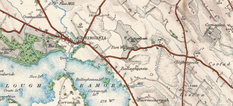
Virginia, Parish of Lurgan.
The town stands on the townlands of Rahardrum and Virginia.
1821 Census: Population 503. We list 510 individual returns on the CT Virginia town homepage. The town straddles the townlands of Virginia (72 entries) and Rahardrum (164 entries).
TAB 1825: 56 entries for Virginia have been re-indexed to the CT Virginia town homepage. 19 entries are listed for the townland of Rahardrum (‘Raharnum’) and should be consulted also.

Ballyhaise 1821 Census
This article by Steven W. Morrison provides an overview of the significance of the 1821 Census of Cavan with particular emphasis on the town of Ballyhaise in the parish of Castleterra. This in-depth analysis of the returns for Ballyhaise will be of interest to local historians and anyone researching ancestors in the Ballyhaise area. It also acts as a useful guide to navigating this very important dataset which has survived for almost half of County Cavan from 1821.
Reproduced with thanks to Trevor Parkhill, editor of Familia and the author Steven W. Morrison. This article originally appeared in Familia: Ulster Genealogical Review 33 (2017): 39-57.

Census of 1821
IMPORTANT
This search facility requires the user to filter by Parish first. If you do not know the parish, please use the Search by Name page instead.
This is the earliest census of Cavan to be completed and c.80,000 individual records listing entire families are available to search. Cavan researchers are fortunate that a significant proportion of the 1821 census has survived. The records cover 17 of the 36 civil parishes of county Cavan and provide a complete listing of all individuals residing in those parishes. The returns include name, age, sex, occupation and home townland. The NAI has made available these records on their website but many of the indexation and transcription issues previously encountered with the Tithe Applotment Book records (1832) also apply here. Even more unusual is the fact that a search on the NAI site will produce duplicate records for each original entry. We have established that two sets of photographs were taken of each original enumerator return page. The duplicate photographs were transcribed in full and the results, which do not always match, were combined and uploaded as a single record. Of the 160,000 records presented we had to use our best judgement to decide what we felt were the most accurate transcriptions and whittle the 160,000 names down to the correct figure of c.80,000 individuals. This work also involved the re-indexation of the townland names to their correct Logainm classification and the compiling of this new dataset into a usable document. Note we have not attempted to update the surname transcriptions which, unfortunately, are not very reliable in many instances. We recommend that any records encountered be verified by cross checking with the original photographed records which can be viewed on the NAI site. You can now search the census records by filtering parish, townland, surname, first name, occupation etc. The search engine supports predictive text which makes searching easier too.
Cavan County Library have compiled a townland index to their microfilmed copies of the 1821 census records which have survived. You can view the index here.
Census records have survived for the parishes highlighted in blue. Click on a parish to view all of the data for that parish. Use the filter at the top of each column to reduce the data. You can filter on the Townland, Surname, Forename, Occupation and Relation to Head by entering any sequence of characters within the text. Bear in mind that names which have been transcribed are often misspelt. Results are filtered as you type.
Tip: If you are searching for a name starting with O’ (for example, O’Brien), enter “brien” in the column filter. Or if searching for “Mc” names (for example, McCormack), enter “cormack” in the column filter.
Note: As of October 27, 2021, we have split the data by Parish for performance reasons.
Click on a parish to search the 1821 records here:
Parish Records
Related Articles
Index to 1821 Census
Courtesy of Cavan County Library we reproduce below their index to the townlands for which the 1821 census returns survive ...
Castlerahan parish, an edited transcription of the 1821 Census
Introduction We present below an edited transcription of the 1821 Census of Castlerahan (Castleraghan) Parish, courtesy of the author, James L. Brady. This transcription and analysis of the census returns ...
Lurgan parish, an edited transcription of the 1821 Census
We present below an edited transcription of the 1821 Census of Lurgan Parish, courtesy of the author, James L. Brady. This transcription of the census returns of the parish of ...
Drumloman Parish, notes on the 1821 Census
Introduction This article, by John P. Wilson, first appeared in Breifne 1963 (Vol.2 No. 6, pp 238-247). We would like to thank Cumann Seanchais Bhreifne for permitting us to re-publish ...
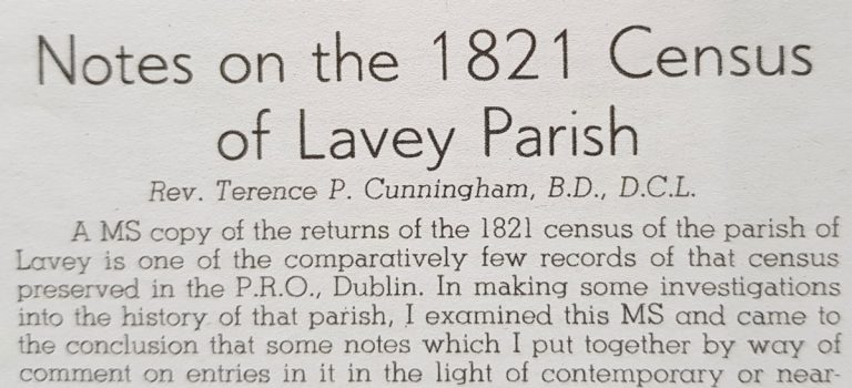
Lavey Parish, notes on the 1821 Census
Introduction This article, by Rev. Terence P. Cunningham, BD., D.C.L., first appeared in Breifne 1960 (Vol.1 No. 3 pp 192-208). We would like to thank Cumann Seanchais Bhreifne for permitting ...
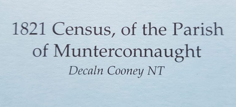
Munterconnaught Parish, 1821 Census
Introduction This article by Declan Cooney NT on the 1821 census of the Parish of Munterconnaught first appeared in Breifne 1998 (Vol. 9 No. 35, pp 877-883). We would like ...
Ballyhaise 1821 Census
This article by Steven W. Morrison provides an overview of the significance of the 1821 Census of Cavan with particular emphasis on the town of Ballyhaise in the parish of ...
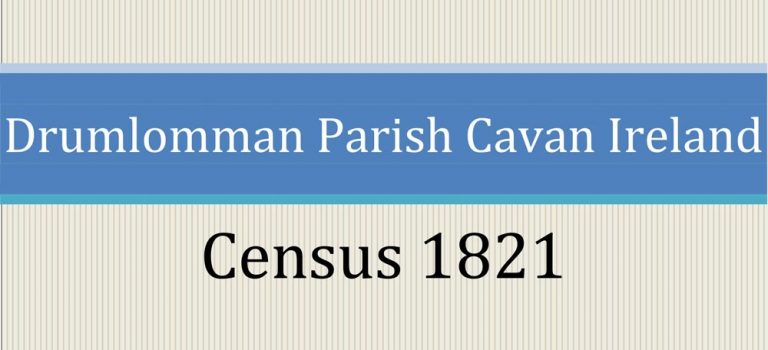
Drumlumman Parish Census 1821
Thesis on the 1821 Census for the parish of Drumlumman (Drumlomman) ...